


Electronic data and communications is considered as a crucial element for the contemporary business. However, when we discuss geospatial technologies, well, it is still in its developing stage. While IoT applications highlights endpoints set up with sensors as its main source of data collection, geospatial technology on the other side, support GPS/GNSS location networks to collect data before moving the specific data to be processed in the cloud. Here we will discuss more about geospatial technology and how cloud services can help shape it.
Legacy geospatial technology
Geospatial technology has a synergetic relationship with computer science and now with the need to automate repetitive process and computer technology, the latest geospatial systems has to be adopted. Back then, standard project deliverables consisted of hardcopy drawings and reports. That means it used legacy approaches to analyze the data, which was quiet inconvenient and a rather sluggish process as the results often came as 2D drawings along with written analysis. Thus to make things more efficient, most of the deliverables were moved to electronic formats and now CAD files, reports and spreadsheets have become common in most enterprises.
Now after applying the new approach, geospatial enterprises are able to share deliverables quickly and smoothly. Right from data acquisition to information dissemination, nearly all of geospatial systems are now making modern electronics, communications and computer systems a part of their industry. As a result, cloud technology for the management and analysis of geospatial information will likely deliver better flexibility in organizational operations.
Although the new wave has introduced considerable acquisition in terms of productivity, the geospatial world has yet to comprehend the significance of cloud.
Cloud solution advantages to geospatial world
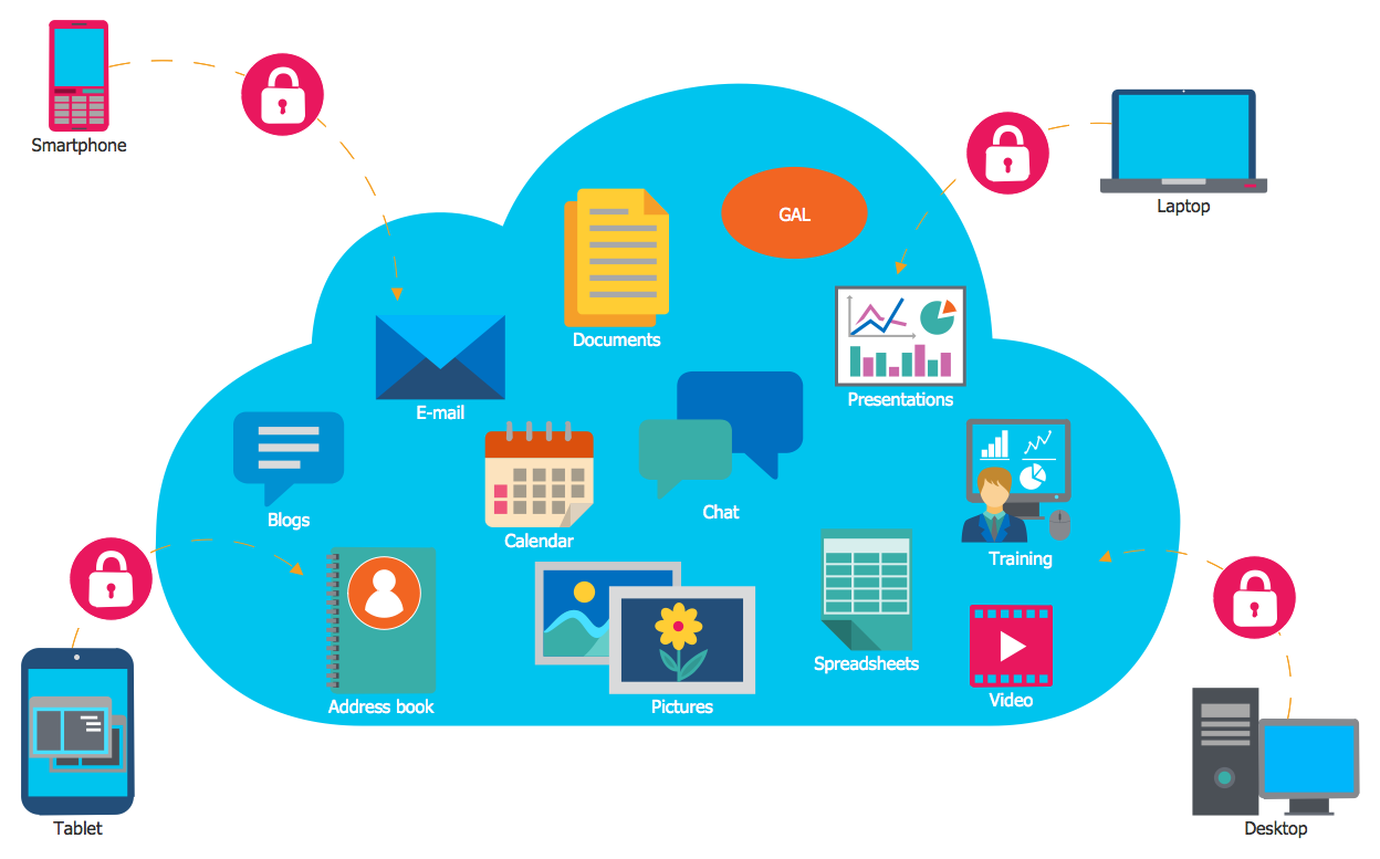
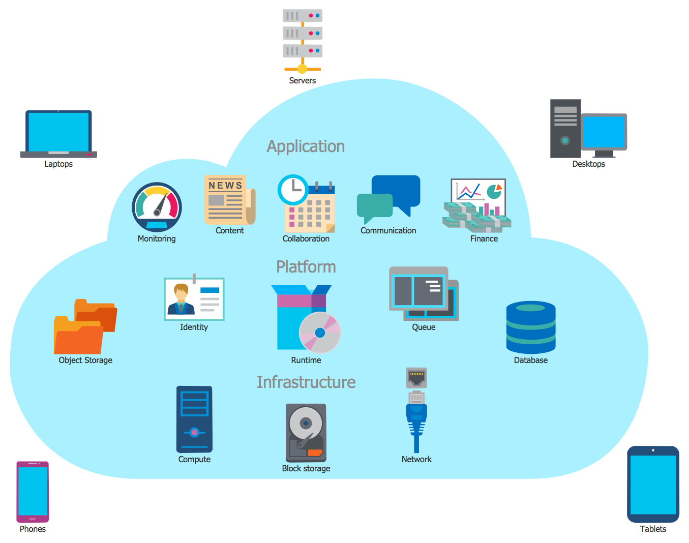
With a vast evolution in the spheres of technology, there are now cloud-based platforms of software, data and related services available to better meet the demands of the geospatial industry. The ingrained technology uses cloud services to support the task engaged in the geospatial environment such as data collection, data management, spatial data catalogs, etc. Integration of cloud services with technologies involved in the geospatial community enables the organizations to effectively accomplish the task and achieve the efficiency that is been looked upon by the geospatial professionals in the field.
Let’s make this more simpler with an example. So how exactly cloud proves beneficial here? Cloud computing enables the geospatial professionals to locate all their essential data under one roof rather than keeping a chunk of it at different location. For instance, a surveyor requires a bunch of data to arrange and execute a particular project and this counts in data from previous surveys conducted, data from government, maps and other related information. What’s complicated here is all the data is not maintained at a single location. Some may be held in the surveyor’s possession, while the rest may come from private organizations, government bodies and so on.
Cloud technology has helped made this less burdensome. Cloud service providers offer tools that enables to store mission-critical data at a single location, making it quicker to find and use the information specific to the project. This eliminates the need to go through the bundle of data and formats manually and enables to simplify standard and time-consuming pre-survey jobs. With the cloud service, the individual can access the geospatial data and download it to his system.
Moreover, the solution is a real benefit for those on the field as well because they can use cloud applications and hosting solutions to transfer information to streamline workflows and data management. Field crews can also keep a record of and manage the location and status of equipment used in field in addition to software and firmware. The latest software services enables surveyors to customize system to simplify data collection on several platforms such as Windows and Android. The best part is that the system can synchronize field data from multiple crews to a single server.
About Web Werks India Pvt. Ltd.:
Web Werks is an India-based CMMI Level 3 Web Hosting company with 5 carrier neutral data centers in India and USA. Started in 1996, Web Werks has served several Fortune 500 companies with successful projects in the areas of Web Hosting, Data Center Services, Dedicated Servers, Colocation servers, Disaster Recovery Services, VPS Hosting Services, and Cloud Hosting.
For further information contact:
Web Werks India Pvt. Ltd.


No Comments